What Data Does a Fishing App Actually Use?
Almost entirely public government data. Weather forecasts, tide predictions, marine buoy readings, river gauge levels and charted depths are all published openly by federal agencies, free to use, with no key required for some of them. An app's work is combining those feeds and locating you within them — not owning secret data. What often gets lost in that assembly is the caveat each agency attaches.
Key takeaways
- The National Weather Service states its API data is open data, free to use for any purpose, with no fees.
- Tide predictions are calculated from 37 harmonic constituents — and cannot include wind, rain or runoff.
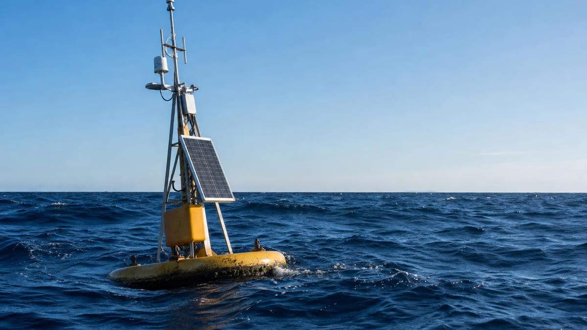
- Buoy water temperature is a surface reading taken at the hull's waterline, not the temperature at fishing depth.
- Recent river gauge data is marked provisional and may be revised or wrong.
- Bathymetry data carries an explicit 'Not to be used for navigation' stamp from the agency that publishes it.
The data is public, and it is free
There is no secret dataset behind a fishing app. The National Weather Service publishes a forecast API and states directly that all of the information presented through it is intended to be open data, free to use for any purpose, with no fees charged for the service. It does not even require an API key — a user-agent identifier is the only authentication.
The same pattern holds across the other feeds. A federal tides and currents service publishes an API for retrieving observations and predictions, covering water levels, tide predictions, currents, water and air temperature, wind, barometric pressure and salinity. Moored buoys publish marine observations. National water services publish river discharge and gage height.
So what does an app actually contribute? It assembles. Five separate feeds, in different formats, keyed to different station identifiers, resolved to wherever you happen to be standing, on one screen. That is genuine work and it is worth something. It is just not ownership of information nobody else has.
How a tide prediction is made
Tide predictions are astronomy, calculated years ahead, and understanding how they are built explains their most important limitation.
Each tidal constituent is a mathematical value describing the effect that the cyclical motion of the Earth, Sun and Moon system has on the tides. Thirty-seven of them normally have the greatest effect and are used to predict tidal conditions. The prediction works by adding the effects of each of those 37 cosine curves together to produce the complex curve you see in an app.
Getting there takes observation. A minimum of 30 days of data is needed to observe the majority of the lunar and solar cycles, and a full year is necessary to directly observe all 37 constituents.
Now the limitation, stated by the agency itself: it can only predict astronomical tides — water level changes created by gravity and the relative motions of the Earth, Sun and Moon — and cannot predict the effect that wind, rain, freshwater runoff and other short-term meteorological events will have. The example given is unambiguous: in one bay, winds blowing along its length have been known to push water levels one to two feet above or below the predicted tide.
A foot or two is not a rounding error when you are wading a flat or clearing a bar. The tide time in your app is a calculation about the Moon, not a measurement of the water.
What a buoy reading actually is
Marine observations are more specific than the labels in an app suggest, and the specifics matter for fishing.
Significant wave height is calculated as the average of the highest one-third of all wave heights during a 20-minute sampling period. Wind speed is averaged over eight minutes for buoys and two minutes for land stations, and reported hourly. Most stations report hourly, with most data available by 25 minutes past the hour.
The one anglers most often misread is temperature. Sea surface temperature from a buoy is referenced to the hull’s waterline, and on fixed platforms varies with the tide. It is a surface number. In a stratified lake or coastal water in summer, the temperature where your bait is sitting may be nothing like it — which is the whole subject of our water temperature article.
Real-time buoy data has also had automated quality control applied as it arrived. Automated, not final. That is different from unchecked, and different from verified.
Provisional means provisional
River data is the feed where the caveat is most explicit, and it is the one anglers on rivers rely on most.
The national water service marks recent data provisional and states that these data should be interpreted with caution, as it is possible — although unlikely — for them to be incorrect. Its full provisional data statement is blunter: the information is preliminary and subject to revision, may be inaccurate due to instrument malfunctions or physical changes at the measurement site, and users are cautioned to consider its provisional nature carefully before using it for decisions concerning personal or public safety, or business with substantial consequences.
Wading a river in high water is a decision concerning personal safety. The gauge reading in an app is almost always the provisional number.
The warning that belongs to the data
Depth information carries the sharpest caveat of all, and it travels with the data rather than with whoever displays it.
The federal bathymetry product used for seafloor topography is published with the explicit statement “Not to be used for navigation,” alongside a note that the agency cannot provide any warranty as to the accuracy, reliability or completeness of the data. Its stated purpose is scientific display of seafloor topography.
Charts are a separate product, built to international hydrographic standards and updated on a working-day cycle. Bathymetry rendered as pretty contours in a fishing app is not that. This is exactly why our own depth maps page repeats the navigation warning rather than tucking it into terms of use — the warning is part of the data’s meaning, and stripping it changes what the data says.
The one thing you supply
Everything above flows in from public sources. The single input that comes from you is your location, and it deserves treating carefully.
Regulators consider location data sensitive for concrete reasons. In an enforcement action against a location data broker, the Federal Trade Commission described how geolocation data can reveal not just where a person lives and whom they spend time with but also which medical treatments they seek and where they worship, and noted that raw location data of this kind is not anonymised and is capable of matching a consumer’s mobile device to the places they visited. The data in that case had been collected through software development kits embedded in third-party apps, and the order required deletion, a consent-withdrawal mechanism and a retention schedule.
The federal privacy framework makes a related point that is easy to miss: privacy risks can arise by means unrelated to any security incident, and managing cybersecurity risk contributes to managing privacy risk without being sufficient for it. Nothing has to be breached for location handling to be a problem.
What that means in practice for any fishing app, ours included, is that location should be used to answer the request in front of it and not accumulated into a history of where you go. Ours is processed per request rather than used to build a profile, which our privacy policy sets out in full. It is the one piece of data in this whole article that is yours rather than the public’s.
What it cannot do
- An app cannot make a forecast more certain than the forecast it received. Errors in the source propagate straight through.
- It cannot predict the weather component of a tide. Agencies publish astronomical tide predictions and say directly that wind, rain and runoff are not included.
- It cannot turn provisional gauge data into verified data. Recent readings may be revised, and agencies warn against using them for decisions with real consequences.
- It cannot make charted depths safe for navigation. The bathymetry warning belongs to the data, not to whoever displays it.
- It cannot know conditions between buoy reports. Most stations report hourly, and wave height is an average over a 20-minute sampling period.
Frequently asked questions
Where do fishing apps get their weather data?
Overwhelmingly from public government sources. The National Weather Service publishes an API which it describes as open data, free to use for any purpose, with no fees and no API key — only a user-agent identifier. Marine conditions come from moored buoys, tide predictions from a federal tides and currents service, and river levels from national water data services. All are open.
How are tide predictions calculated?
By harmonic analysis. Each tidal constituent is a mathematical value describing the effect of the cyclical motion of the Earth, Sun and Moon system, and 37 of them normally have the greatest effect. The prediction adds together the effects of 37 cosine curves to produce the tide curve. A minimum of 30 days of observation is needed to see most lunar and solar cycles, and a full year to observe all 37 constituents directly.
Why is the actual tide different from the predicted tide?
Because the prediction deliberately excludes weather. The agency states that it can only predict astronomical tides — water level changes caused by gravity and the relative motions of the Earth, Sun and Moon — and cannot predict the effect of wind, rain, freshwater runoff and other short-term meteorological events. In one bay it gives an example of winds pushing water levels one to two feet above or below prediction.
Is the water temperature in my app the temperature where the fish are?
No. Buoy sea surface temperature is referenced to the hull's waterline, and on fixed platforms it varies with the tide. It is a surface measurement. The temperature at the depth you are fishing may be very different, particularly in summer when a lake or coastal water is stratified.
Can I get this data myself?
Yes, all of it, free. The forecast API, the tides and currents API, the buoy data files and the river gauge services are public. What an app saves you is assembling five feeds and locating yourself within them. What it can cost you is the warning the agency attached, which is why we reproduce those warnings on our feature pages instead of stripping them out.
Related reading
Sources
- Weather.gov API Web Service documentation — National Weather Service. Accessed August 6, 2026.
- CO-OPS Data API — tides, currents and meteorological observations — NOAA Center for Operational Oceanographic Products and Services. Accessed August 6, 2026.
- Understanding Tidal Harmonic Constituents — NOAA Tides and Currents. Accessed August 6, 2026.
- Tides and Currents FAQ — what predictions can and cannot include — NOAA Tides and Currents. Accessed August 6, 2026.
- Measurement Descriptions and Units — NOAA National Data Buoy Center. Accessed August 6, 2026.
- Real Time Data Access — NOAA National Data Buoy Center. Accessed August 6, 2026.
- Instantaneous Values Service details — US Geological Survey Water Services. Accessed August 6, 2026.
- Provisional Data Statement — US Geological Survey. Accessed August 6, 2026.
- Coastal Relief Model metadata — not to be used for navigation — NOAA National Centers for Environmental Information. Accessed August 6, 2026.
- FTC order prohibiting a data broker from selling sensitive location data — US Federal Trade Commission. Accessed August 6, 2026.
- NIST Privacy Framework — National Institute of Standards and Technology. Accessed August 6, 2026.
How we choose sources: sources policy.
More in this series
See the conditions for your own spot.
Fishing Club AI turns live weather, pressure and moon data into an hourly forecast — and shows you which factors moved the number.
Get the App